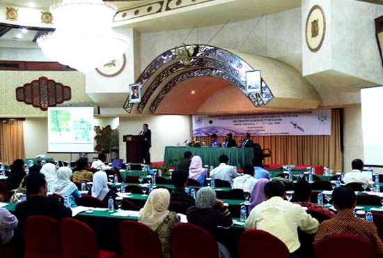
Report of the United Nations/Indonesia Regional Workshop on Integrated Space Technology Applications for Water Resource Management, Environmental Protection and Disaster Vulnerability Mitigation
Hosted by the National Institute of Aeronautics and Space (LAPAN) July 7-11, 2008, Jakarta, Indonesia
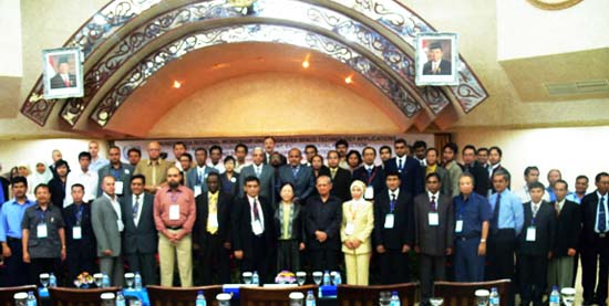
The United Nations/Indonesia Regional Workshop on Integrated Space Technology Applications for Water Resource Management, Environmental Protection and Disaster Vulnerability Mitigation was held in Jakarta, Indonesia, from July 7 to 11, 2008. More than 100 people from the following countries and the Office for Outer Space Affairs attended the workshop: Indonesia, Iraq, Iran, Laos, Maldives, Myanmar, Nepal, Pakistan, Saudi Arabia, Sri Lanka, Sudan, Syria, Thailand, and Vietnam.
A. Objectives and topics
The overall objective of this regional workshop is to promote the integrated use of the demonstrated capabilities of space technology to support national, regional and international efforts for water resource management and environmental protection. These efforts can reduce problems with water and water supplies caused by natural disasters, and help prevent those problems from happening. This workshop will focus on using space technologies to improve water and environmental management and to reduce natural disasters such as floods, droughts, and water-related disasters caused by climate change, deforestation, forest fires, and misuse of land.
Specific objectives are:
- To encourage the use of space technologies in integrated applications such as improved understanding of environmental protection and water resource management to help reduce the effects of water-related natural disasters and help to prevent them from happening;
- To increase decision makers' and managers' awareness about the benefits of using space technologies for environmental development, an aim that was declared at the World Summit on Sustainable Development;
- To enhance interaction between space research and the development community and decision makers;
- To discuss the strategy for including space technology applications and information in the decision-making processes involved in monitoring water resources and environmental protection, in order to improve disaster management that is related to water problems;
- To examine what low-cost, space-related technologies and informational resources are available for addressing environmental sustainability and disaster management;
- To strengthen international and regional cooperation in the above areas.
Specific topics are:
- Using space technologies to solve issues related to water management and strategies to reduce disasters caused by water;
- Methods of conserving the environment that are related to water resources and atmospheric pollution and strategies using space technologies;
- Issues related to climate change and LU/LC and strategies to reduce the number of disasters using space technologies;
- Effective environmental protection approaches using space technologies;
- Case studies on successful practices of the above, and lessons learned from the application experiences;
- Group discussion session to launch practical, low-cost or free projects.
C SUMMARY REPORT OF THREE WORKING GROUPS
Three Working Groups will be established to prepare observations and recommendations of the conference as well as to develop proposals for possible follow-up projects. A summary of three working groups is as follows:
1. Working Group 1: Spatial Data Processing, Analysis, and Application
Objectives: To identify areas where the participants of the working group can work jointly and can share expertise using space technology. The following areas were identified: (i) agriculture (crop monitoring) (ii) water resources (hydrological and hydrodynamic modeling) (iii) environment (land use and land cover mapping, drought monitoring, monitoring deforestation) and (iv) mineral resources (mineral resource mapping using remote sensing).
The outcome will be pilot projects in the participant's country. Ultimately the institution will acquire skills and expertise in the field of space technology.
Description of pilot projects:
- Monitoring rice crops using remote sensing (Bangladesh and Indonesia)
The main objective of this project will be to map crop acreage. Bangladesh and Indonesia are interested in implementing this project in their countries. The rest of the group will share their learned experience. The estimated duration of the project will be one season, i.e., four months. Note: Bangladesh plans to begin the project in autumn and will need RADARSAT data.
Output: Separate reports on crop acreage in Bangladesh and Indonesia. - Watershed management, hydrological and hydrodynamic modeling using remote sensing and GIS (Bangladesh, Bhutan, Laos, Nepal, Pakistan, Sri Lanka, and Thailand)
The countries of Bangladesh, Bhutan, Laos, Nepal, Pakistan, Sri Lanka, and Thailand are interested in this project. They will start with their own data and get help from persons with resources, i.e. Muhammad Farooq, Mr. Veroni, and Mr. Htut. The study area will be decided by the participating counties after they have had discussions with their institutions upon arriving back home. The estimated duration of the project will be 6 to 12 months.
Output: A report on discharge predictions and the extent of floods in respective countries. Note: Most of the countries will need to build capacity in the field of flood modeling. - Environmental analyses using space technologies (Indonesia, Laos, Myanmar, Nepal, and Vietnam)
This project has a broad scope in several aspects. The WG members decided to focus on the following aspects:
- Land use and land cover mapping in Laos and Vietnam
Output: Land use and land cover maps. Note: Laos and Vietnam need satellite data for this project. The estimated duration of the project will be six months. - Monitoring the deforestation of rubber trees in Laos
Output: Deforestation mapping. - Drought monitoring in Indonesia
Output: Preparation for droughts. Note: Indonesia needs GMS Data for this case study. The duration of the project will depend on the availability of data. - Monitoring air pollution in Katmandu, Nepal
Nepal requires expertise and technology to monitor air pollution using space technology in Katmandu. The duration of the project will be four to six months. - Post disaster analysis of Nargis Cyclone in Myanmar
Note: Myanmar requires free, high-resolution data from Earth Observation Satellite operators (IKONOS, Quick Bird, SPOT).
Since July 1, 2003, the UN OOSA has been a body cooperating with the International Charter Space and Major Disasters, a mechanism through which any entity of the United Nations' system for responding to an emergency can request and receive free satellite data. The website of the International Charter Space and Major Disasters is: http://www.disasterscharter.org/
You can obtain specific disaster data from this page. Data on the recent cyclone in Myanmar is available at: http://www.disasterscharter.org/disasters/CALLID_203_e.html
If members of Myanmar need further assistance, please contact Sergei Chernikov or Alice Lee of UN OOSA. The estimated duration of the project will be three months.
Output: Mapping of affected areas and planning for rehabilitation. - Mineral resource mapping using remote sensing technology (Indonesia, Pakistan, and Thailand)
Indonesia, Pakistan, and Thailand are interested in mapping mineral resources using remote sensing and GIS. However, the members of the working group have no experience in this area. So the WG suggests that the UN arranges some opportunities for them to build capacities. The participating countries will arrange all the satellite data and other data from their own resources. The estimated duration will be approximately six months.
Output: Mineral resource maps and databases.
- Land use and land cover mapping in Laos and Vietnam
The participating countries in these pilot projects will devise the detailed methodology for the projects which includes the study area, data required, tools, analysis, and output. Also they will pinpoint what type of further assistance they need from the working group and UN OOSA.
2. Working Group 2: Capacity building, training, and education
Objectives: To improve the quality of human resources in member countries in order to increase the capability of working in the fields of environmental management, natural resource monitoring, and disaster management by using space technologies.
Intended products:
- A weblink for exchanging information and sharing data, imagery and expertise. Possibly through the use of open source web-database and e-mailing.
- Joint projects (bilateral, trilateral, or multilateral among the members of the WG) in capacity building, including training and education.
Major Tasks:
- To provide information of available training events and facilities in member countries (Egypt, Indonesia, Iran, Iraq, Sudan, Syria, and Turkey), and in organizations such as AIT, DLR and ITC.
- To establish a coordination body on national, regional, and international levels.
- To identify target groups for training and education.
- To strengthen and share the infrastructure of remote sensing, such as ground stations, GPS, satellites, software, and hardware in member countries.
- To enhance member country's skill levels in using space technology, with assistance from Japan, China, and France.
Ways and means of implementing the tasks:
Funding:
Seek funding sources from governmental, regional, and international organizations such as African Unity, Arab Unity, UNDP, UNESCO, the EU, and USAid.
INDONESIA
Main fields of interest: Floods, tsunamis, earthquakes, wetlands.
Experience:
- Has own ground stations.
- Receives NOAA, GMS, Feng Yun, Landsat, MODIS, SPOT data.
- Training and education in RS/GIS are backed by six major universities. The trainees can come from overseas.
- Last two years: Training in image processing and disaster management conducted by LAPAN. Funding provided jointly by LAPAN and participants (local governments).
- Participation in multi-discipline training: Data archive and processing (in DLR, Germany; funding by DLR), radar interferometry (in Aerosensing, Germany; funding by DLR), environment monitoring and disaster management (masters degree in India and China; funding by India and China), Open Web-GIS (in AIT, Thailand; funding by AIT), wireless communication (in Jakarta; funding by LAPAN).
Future Prospect: INA Tsunami Early Warning System (main sponsor was the German government).
3. Working Group 3: Policy Establishment
Objectives: To improve the effectiveness, efficiency, and ethicality of space science and technology development, as well as its utilization and applications.
Outline of Major Tasks:
Task 1: To create a compendium of space-related policies
It is important to identify the existing policies in international, regional and national levels and use them as examples for establishing our own policy. Questions to be answered for this task are:
- Are there any space-related policies at national, regional and international levels, such as agreements, charters, conventions, laws and regulations, strategic plans, technical guidance?
- Are those policies well administered, well socialized, well implemented and controlled?
- Are there any space-related policies being established at national, regional and international levels?
An example of an existing international practice and policy is the International Charter Space and Major Disasters: http://www.disasterscharter.org/. This is a mechanism through which any entity of the United Nations system responding to an emergency can request and receive free satellite data. When a tsunami occurred in Aceh in 2004, an earthquake hit Jogjakarta in 2006, and an earthquake hit West Sumatra, the relevant parties were able to receive data about the disaster areas and that helped them to understand the kind of rescue response required.
Examples of regional level practices and policy are:
- ASEAN SCOSA (Sub Committee on Space Application) countries that have ground stations to receive remote sensing data should share that data with neighboring countries hit by disasters (Indonesia, Malaysia, Singapore, and Thailand).
- SENTINEL ASIA motorized by APRSAF (Asia-Pacific Space Agency Forum) and ADRC (Asian Disaster Reduction Center).
Implementation examples are:
Phase I (2006-2007): Monitoring of wildfires and floods for early warning, and emergency responses to disasters.
Phase II (2008-2012): Sentinel Asia for Environment (SAfE) for environmental monitoring.
Examples of national level practices and policy are: (Indonesia)
- Law No. 24, 2007 (Disaster Management)
- Law No. 26, 2007 (Spatial Planning)
- Presidential Decree No. 85, 2007 about JDSN-National Data Spatial Network
Coordinator: National Survey and Mapping Agency (BAKOSURTANAL), remote sensing satellite data - National Institute of Aeronautics and Space (LAPAN), Forestry - Ministry of Forestry, Cadastre - National Land Agency (BPN), Mining and energy - Dept. of Energy and Mineral Resources (ESDM), meteorology & geophysics - Meteorology and Geophysical Agency (BMG)).
Task 2: To find out which space policies are needed
This task aims to identify the needs and trends of space policies at national, regional, and international levels. Before performing this task, questions to be answered are:
- Are there any problems with the needs for policies at national, regional and international levels?
- Which are the responsible institutions that have to start establishing the policies?
- Are there any standard procedures that have to be respected in establishing the new policies?
Task 3: To improve the existing mechanism of establishing space policies
Questions to be answered when performing this task are:
- Which existing mechanisms (standard procedures) are to be improved, and why?
- Who has to be involved in improving the existing mechanism?
- What criteria have to be used to test the improved mechanisms?
Intended user of these tasks:
The output of these tasks will be used as an input to the policy of the Indonesian national space information system.
Ways and means of performing these tasks:
- Sources of budget will be from APBN, a national budget.
- Responsibility of each member in this WG: Because all members of this working group are Indonesians, this WG is also a national team. The team will be led by the chair and co-chair persons, and will be coordinated internally, synergizing with the members' existing work.
- The team has been divided into two groups:
- Research and Development on Space Science and Technology:
LAPAN, BPPT, POSTEL, LIPI, Universities, Department of Defense, Department of Industry, Bakosurtanal, BMG, and PT Telkom. - Space Science and Technology Application:
LAPAN, BNPB, ESDM, Bakosurtanal, BMG, Universities, Ministry of Forestry, Department of Public Works, Ministry of Agriculture, Ministry of Environment, Department of Home Affairs, BPN, Department of Defense, Department of Marine and Fisheries, Department of Transportation, Depkominfo, Army, Navy, and Air Force
- Research and Development on Space Science and Technology: