JAXA acquired image data on disaster-hit Leyte Island through the "Daichi"
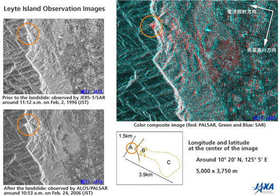
JAXA took and analyzed image data on Leyte Island, where a huge landslide occurred, through the Phased Array type L-band Synthetic Aperture Radar (PALSAR) aboard the Advanced Earth Observing Satellite "Daichi." We have provided the data to the International Charter "Space and Major Disasters" and the Asian Disaster Reduction Center (ADRC).
- Press Release
- Advanced Land Observing Satellite "Daichi" (ALOS)
- Earth Observation Research and Application Center
- Earth Observation Center